Rides & reports of motorcycle adventures..

9/28/08

9/26/08 AZ:Jerome, Wing Mtn, Oak Creek Canyon

Everyone is so busy! .. finally we got together & went on a ride. After my epic utah & montana ride, it was good to be back on the az trails. Kim's foot has been hurting, so we wanted something easy...

Right.

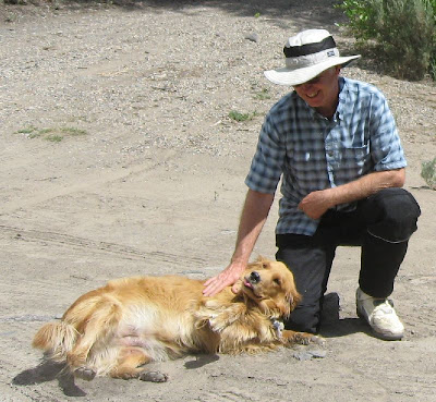
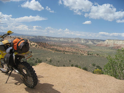
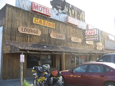
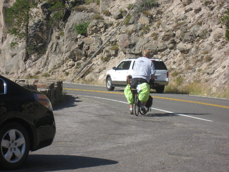
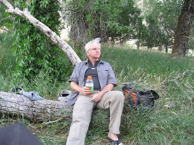
Kim, Tom, & I met in Jerome this last friday. We took the perkinsville road out of jerome & toward williams.

From rides


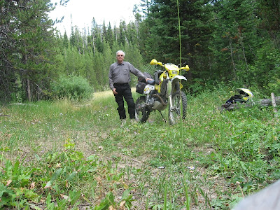
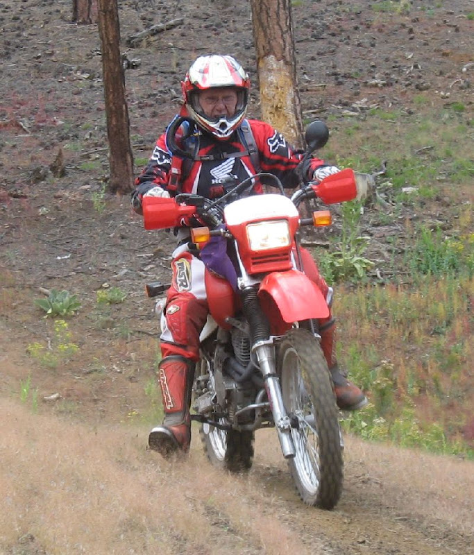
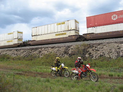
The meeting spot. 2 Drz's & a honda 650L.

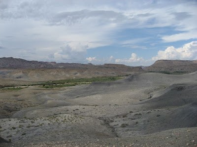
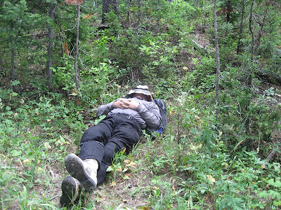
I'm sprinkling in a few video clips.. still getting used to the helmet cam. This is a section along the perkinsville road, along the side of Mingus Mountain. I need to edit them.. these are straight from the helmet cam with the lousy audio.. no cool headbanging music..


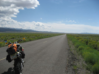
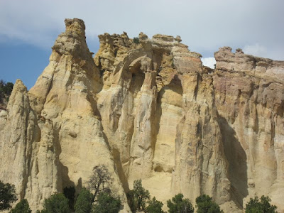
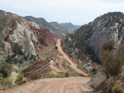
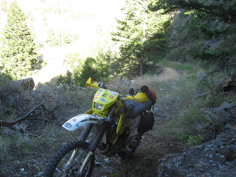
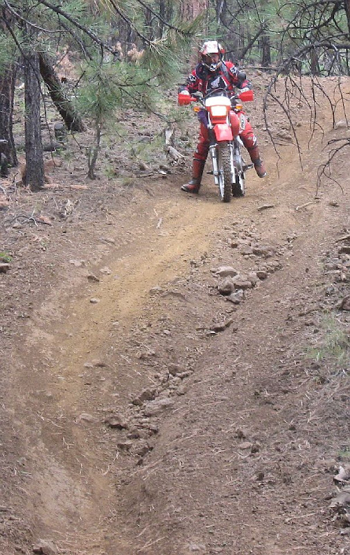
The perkinsville road is pretty easy.. it winds around some, & there's loose rock & gravel, but it's an easy ride for Kim's foot. But we got off the easy road, & went up another toward williams.. this road had lots of loose rocks, some big steps, plenty of blind curves.. a great road!

From rides


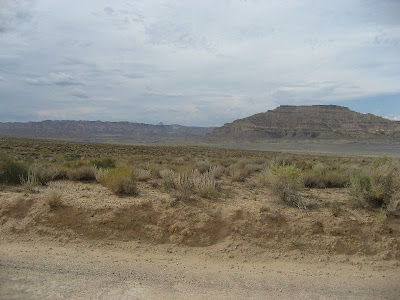
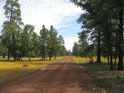
As we climbed higher in elevation, the wildflowers were blooming everywhere. There were big sections of bright yellow along the road & across the vistas intermittent patches of yellow dotted the views.

From rides


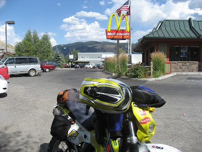
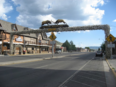
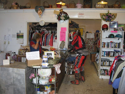
We made it to Williams around noon, gassed up & had lunch. Dark clouds were piling up, & it started to sprinkle. Tom had forgotten his jacket (we were just going up into the mountains, after all), so stopped at a local thrift store to buy a sweatshirt.

From rides


He was a real hit with the ladies (as usual) in the thrift store.

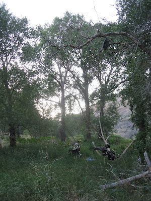
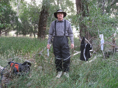
Now is the section of few pictures. The rain was getting heavier, so we stopped & Kim & I put on our rain jackets. We were heading north across I-40 up to garland prairie road, then across old rt. 66 to wing mountain single track. Tom & I crossed under the freeway, then waited for Kim.

We waited some more.

I turned back to see if he slid off the road into a ditch.

No Kim.

We rode back to where we put on our jackets & waited.

No Kim.

I figured he turned off at the spot where we go toward garland prairie, lost us, then went on. The rain made visibility tough.. our goggles were wet & dripping. We rode up to the garland prairie turnoff, & then crossed the highway & got on old rt. 66. I checked my cell phone. Kim had left a message! He had turned onto the freeway in the rain (probably following a harley & thought it was Tom.. he gets that a lot..). He said he would continue in to Flagstaff, & go shopping at walmart.. I tried calling him back, but just got voicemail. I told him not to go to walmart, but turn back or exit at the navajo armory & wait for us. But he never got the message. We stopped after few miles & i called again. After a couple more stops, we made a connection! That's one nice thing about being along the freeway.. there is usually cell coverage.

Kim waited for us at the intersection of rt. 66 & the road to wing mtn.

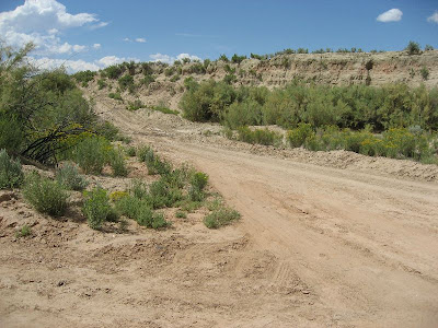
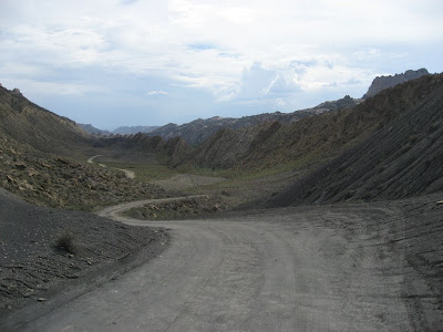
The rain had finally stopped, & it was clearing off a little. We were back on dirt roads.. Tom & I had been on mostly dirt since williams.. we never got on the freeway. The gps showed a road going through to wing mtn, but we talked to a couple of hunters who said that road was closed. So we followed the gas pipeline road to the wing mtn loop road. There were some very steep, loose, & exciting hills along the pipeline road.. I went up one section that had an alternate route.. i thought i was going to lose it, but the back end bounced around, spun & bit, & finally made it to the top.

We made our way to the fence line where the coconino trail riders had made access to the wing mtn singletrack loop. They made it with permission from the forest service.. a great trail & lots of hard work.. Thanks, Guys!.

From rides


It had some pretty steep & narrow bits.. no one dropped, but with Kim's foot, & Tom on the big honda, it was tough with all the up & down, steep, rutted, narrow riding. So we didn't do the whole loop... & we lost part of it, anyway.

From rides


Here's Tom in a short video clip.


From rides


Here's a video with Kim:


This one had the steep. loose climb up toward the end. It didn't match what was on the gps track, so we turned back & came down.. a tough trail for tom's big 650 with high gearing. We came out on the main wing mtn loop road by the snow sledding & cross country skiing area. But it was getting late, so we decided to skip more single track & start heading south. Tom still had to ride all the way to Prescott!

We followed a road south back toward the freeway. It turned out to be worse than the single track! It was more of a river bed than a road. Big boulders were everywhere, but we kept going. I didn't take many stills, but here's a clip after we got through the worst of it.


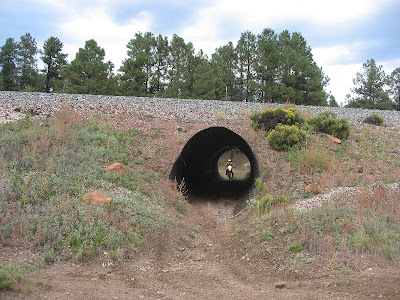
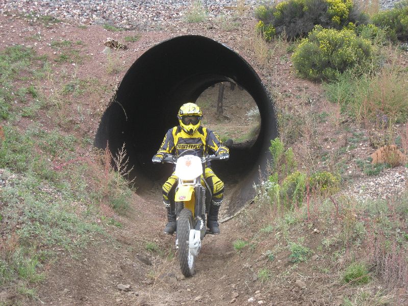
We crossed the freeway near the navajo army depot, but the roads that showed on the gps didn't go through.. someone had built train tracks there, & we couldn't cross. We followed the tracks for several miles, & finally found a big culvert under the tracks.

From rides


From rides


We only had to follow the other side a mile or so until we came to a trail heading south.. it wasn't on the gps, but was going the right direction. The train came after we went under the tunnel.

From rides


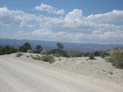
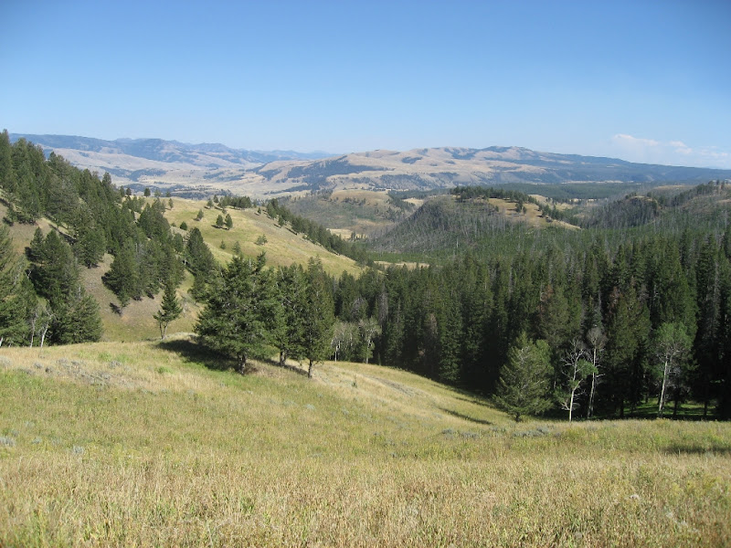
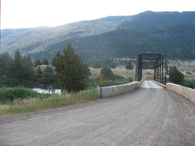
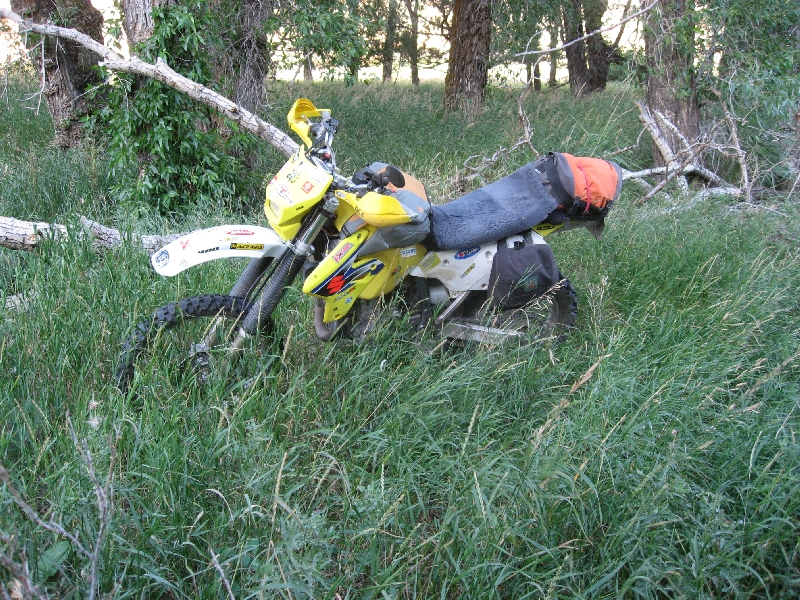
There were some big meadows along the road south. The roads were easy, & after the rain, the dust was down. It hadn't rained enough to make mud. We continued south to fr 535, then took it to 89a above the oak creek canyon switchbacks.. back on pavement!

We descended the canyon.. i took a few more video clips following Tom down the switchbacks.


We got down to Sedona, & Tom continued south on 89a toward Jerome & Prescott, while Kim & I turned toward home. It was about 6:30 when i got home. We had covered over 200 miles, had rain, steep rocky roads, narrow single track, & even some paved twisties. This ride had it all, & no one crashed or got hurt or permanently lost.

I'd like to polish this route up a bit & make it a regular ride. It was much more interesting than i expected, & had a great variety of terrain, nice views, & elevation changes. temps were from the 60's to 80's. Elevations were from 4k to 8k.

Here's the map & track of the ride:

jerome2wing2sedona gpx track

9/21/08

Ogden to Sedona, 8/30/08

I decided to head back home to Arizona during labor day weekend. I didn't want to be on the road on friday, but i thought Saturday wouldn't be too bad for traffic. I got loaded up the night before, & was on the road by 6:30. There wasn't a lot of traffic through salt lake city, & after i got into spanish fork i turned off onto a state hiway, getting off of I-15. I followed 89 south for a while, then took a smaller road that went toward bryce canyon again. This road was desolate. I saw very few cars. Part of it went along a river canyon, where i stopped for a short break.


From rides


I washed off the bugs from my goggles in the river, & had some jerky & water. I made a new friend, who accepted some jerky.

From rides


I continued along this road.. hours went by without seeing a car. The road was paved & decent, & looked to be a shortcut to bryce.


From rides


I had stopped for breakfast in a small town on us89, & was hoping to take a dirt road past bryce canyon back to 89 near page, az.


I stopped for gas & an ice cream in Tropic, where i met a group of sport bikes. They were from the san francisco area, & were riding through utah. They also rode dirt bikes, & were intrigued by my trip... they had hot babes on the back, so weren't really into riding off road. Most of the harley guys also had hot babes on the back of their bikes.. what happened to solo adventure riding? Why bother going if you're going to pack all the baggage.. the whining, always hungry, constant bathroom stops.. & that's just me! Add to that the woman & her talking nonstop, shouting in your ear, & complaining about the wind messing up her hair... why would anyone want to take a woman along on a long interstate bike ride?

..oh..

i guess it does get lonesome..

they are warm & soft & nice to snuggle with..

Ok.. i get it. Next time i'm bringing my own hot babe!


From rides

This is a great road from tropic to near bigwater. It's a lot shorter, too than going all the way to kanab & then cutting over. Somebody put a big hole in the ground so you can't drive straight down to Flagstaff, but have to cut over to Page. But this is a great road. Very little traffic.. i think i saw 2 or 3 vehicles the whole distance, about 55 miles.

From rides

The road is called Cottonwood Canyon, & it follows a canyon, then comes out along the pariah river. It winds it's way along the canyon with some nice views, as well as fun riding. Much of the road was washed out from the rains, so the going was interesting.


This is the view back toward bryce & the central canyons.


There were some turnoffs. This is grosvener's arch (the english pronounce this 'grove-ner's. I don't know how the utahans say it).


The road was nice & twisty.. i was glad there was not a lot of traffic. In a truck or dirt bike, this is a nice short cut to Bryce coming from the south east.


By now it was getting late. When i reached Page, i would still have 3 hours of riding to do. I decided to stop taking pictures & twist the throttle.


Ok, maybe just a couple more..


It was near 6 when i got into Page, Az. I called my wife, who said it was raining. It was clear in Page, but i figured i better get going. I had a coffee & hit the road.

I didn't run into rain until just getting into flagstaff. Fortunately, it was ending. The roads were wet, but it wasn't raining real hard..just enough to sting you while riding. I missed my full face helmet. I had my rain jacket & pants which kept me warm & dry.. mostly. I decided to take the freeway from flag, rather than come down the canyon switchbacks in the rain. By the time i hit the downhill grades into the Verde Valley, the rain was ending, the air was warming considerably, & i was ready for home. I had ridden for about 14 hours, 560 miles, & was beat. It was almost 9, dark, & an empty house.

But i was glad to be off the bike & off the road.

9/13/08

Yellowstone 8/24/08

When i got up, i was glad to see all my clothes were dry. It was a little chilly in the morning, so i did layer up. I also had on both rain jacket & pants. I was pretty hungry, with the sparse eating the day before, so wanted to get going & head back to Gardiner & Yellowstone.


Here was some stuff i didn't use on this trip.


gorilla pod (camera tripod).. i use this a lot when taking pics, but hadn't used it on this trip, yet.


Battery charger, 12v adapter, 120v adapter. Only 3 days.. helmet cam & shaver were still on the full charged batts i started with.

Xena disk lock & alarm. The bike stayed near.. had i stayed in a motel, i might have used it.


Later on i'll summarize what i took, what worked, what i'd take again, etc, for anyone who might be interested.


I didn't take a lot of pics, but did try out the helmet cam again for the ride out.


I asked at the gas station where a good place for breakfast, & without hesitation they said, 'Town Cafe'. That is where i had stopped looking for a room, so i went there & had a big breakfast of bisquits & gravy!


I decided to go all the way back to Ogden in one day. It was Sunday, & I had work to do the next day, so i hit the road.


Going back through Yellowstone, there were still lots of thermal areas.. this day i would see a lot of them. I was going through the geyser spots.


Some of the mountains were just steam vent outlets.


Of course, following the river, there were rapids & waterfalls.


There weren't a lot of bicyclists, but some. This guy was really loaded down. He was carrying a lot more than me, & having to move it without a motor.


Every so often, I'd run into some buffalo crossing the road. Everyone stopped & took pictures.. they don't seem to mind all the paparazzi.. my engine was off, waiting for traffic to clear, & this guy strolled by.. i could have reached out & patted him on the head, but it didn't seem like a good idea.


I was getting thick into the thermal areas.. this spot had lots of pools, pots, & a few small geysers.


Most tourists, if you ask them to take your picture, will put you right in front of whatever scenic spot you want in the pic.. A lady offered to take my pic, & i could see some nice camera gear, & she looked like she was framing it well. She didn't speak english, but got a good shot.. Thanks!


Here's a short video clip of a little geyser.


I got to old faithful & decided to catch it on video. This was the Main Event in Yellowstone. Everyone was there, lots of different languages spoken.. motorcyles & rv's coming & going.


I chatted a bit with this bmw guy..he was from ca. & was doing a tour with a bmw group. It looked much more comfortable than my ride, and he brought all his possessions with him. I think i still like the drz for this kind of trip. I could go anywhere he could, but he couldn't go anywhere i could.


Here's a 1 minute clip of the old faithful eruption. I took it with the helmet cam, holding it in my hand.. so neither the video or audio are very good. Other than that, it's a fine clip.


The full eruption lasted almost 4 minutes. This was the most crowded place in Yellowstone. I did get another ice cream in the store, though..


Time was moving along, & i had a long way to go. I didn't make any more stops in Yellowstone, but started getting tired in the Tetons, so stopped & took a side trail into the woods for a short rest.


Even just a 10 minute break rejuvenates you a lot. I continued & finally stopped in Jackson for fuel & food.. just a fast stop this time.


I wanted to take a picture of this when i came through earlier, but there was too much traffic. It was Sunday, so the traffic was minimal.


It's billed as the largest elk antler arch in the world.. who was i to argue with that? There were some in Jackson, too, but not as big.

It was a good ride back along the snake river, bear lake, & back into utah. I decided to take a different route back from bear lake, since it was nearly dark. I went down Logan Canyon.. another very scenic ride.

It was past 10 when i got into Ogden.. it was pretty chilly going down Logan canyon.. & there were a lot of slow cars out for a sunday night ride, i guess. This was about a 350 mile day.. a long time to sit in the saddle.. but i was back & had a fun ride. I'd be working again the rest of the week, & heading back to Az on Labor day weekend.

9/11/08

Yellowstone 8/23/08

I left the lake area & headed up toward the canyon.. where the falls were. The yellowstone falls & canyon are awesome. The view areas make picture taking easy. Every photo looks like a post card.


The biggest drawback is all the walking you have to do. The parking areas are pretty close, but i still had to walk a lot to the scenic views or other points of interest. I was really impressed with the sidi crossfires. I put several miles on them just walking, & they were pretty good. I had put in a gel sole, though, to soften up the footwork.


The colors & rock formations in the canyon areas were fascinating. They didn't compare to the sheer volume in Bryce, but they had the color pallette down.


You could also get above the falls.. i think this was the upper falls..


Here's a short video of the upper falls:


I continued north along the yellowstone river.. there were some great vistas, & lots of river views along the way.


This is tower falls.. i took a break here (after another long hike to see the falls!). They have local ice cream that has been made & served for years.. it was quite good. I also passed a guy on a harley after i left. He was loaded down with so much stuff, & he probably weighed in over 300# himself. Even the big harley was struggling to climb the hills. I passed him several times along the way. He'd catch me when i stopped to take pics & enjoy the views, then i'd pass him later. You could see the back end of the bike sagging down.


Everywhere you went there was something different. Yellowstone is really a variety of places in one.


Then off the lonely, little traveled road north, i came upon this. That's what i've been looking for! Poor driving conditions? i'll be the judge of that! I went around the sign, being the rogue arizonan, wild west maverick that i am, & eagerly explored some real dirt.


It was a nice road.. very scenic.. no traffic. :)
/>


There were a few spots that had some washed out areas.. some water crossing the roads.. but nothing the drz couldn't handle.. it was glad to be off the pavement & leaped & snorted when encountering the more rugged terrain.


But about 10 miles into the new riding area, i saw a green park truck coming toward me... uh oh... busted. A young park ranger tried his best to chastise me, yelling at me in a breaking voice that the roads were closed for a reason, etc. I tried to act contrite, & he didn't ticket me or anything. I promised to cheerfully obey all the posted signs & went on my way. The road had actually looped back to where i had already been, so i had to come along the same road north toward Mammoth hot springs.


There were a lot of elk & antelope as i got further north. It was also getting late.. almost 5pm.


When i got into the town part of mammoth, the elk were there. Rangers had to put cones up to divert traffic & not let people get too close. These guys have it easy! Nobody shoots at them, they can graze in the park, the cops set up barricades...


It was getting late.. so i left yellowstone & went into Gardiner, Montana to look for a room. What looked like a cheap hotel was $100, & the clerk said all the prices were like that in Gardiner.. perhaps in Livingstone about 80 mile north they might have cheaper rooms. So i filled with gas & continued north. The road went along the yellowstone river.. again, rafters were everywhere.


I could see an interesting road/trail on the other side of the river, but there was no place to cross. The sun was sinking lower, & i decided i'd try to find a place to camp. I went through Yankee Jim Canyon, & got into some areas with houses. There was a turnoff, & the road became graded dirt. Then there was a bridge!


I crossed the bridge & doubled back along the dirt road, looking for a campsite. There were several turnoffs, & a couple of historic site signs telling about this trail.. used by the natives thousands of years ago, then by the first wagon visitors to yellowstone, then by a railroad to take visitors to yellowstone. But when the new highway was constructed, it was abandoned. The trail hadn't been closed to motorized vehicles.. at least there was no sign, but there were rocks piled along so only hikers or bicycles (or small dirt bikes!) could get through. I decided to try & catch this on the helmet cam. The sun was in my face, so the light is a little weird.


Here's a short video clip of a trail along the yellowstone river north of Gardiner in Montana.


This one is a little better, but longer..


I followed the trail for several miles, but cover & access to the river was dwindling, so i headed back to the best spot i had seen. I had to ride off the road for a few hundred yards in very deep grass to a stand of trees near the river. I wanted to wash me, the clothes & get settled before dark.


There were a few more spots of single track, & had i more time, i would have gone further along & explored them. But it was getting late, so i stopped to camp.


My camp site. I was going to pass on the hammock this night, & just lay it on the grass for a ground cloth. I was also not sure of the legality of camping here, so wanted to keep a low profile. I only saw one vehicle go by, but this wasn't nat. forest, so i cut a few branches & tried to obscure the bright yellow & white drz.


I figured i better get myself & clothes washed before it got too dark, & to give as much time as possible to let things dry. It would not be as cold here.. it was about 4k ft, instead of 7500 the night before!

I hung everything out.. but down low so not to be conspicuous.


I wasn't real hungry, so just had some jerky & gatorade for dinner.


I hung up my bear cache & got my bag out as it got dark.


The mosquitos were thick, so when i sat i had to put on my hat & mosquito head net. It worked, though. I was a little worried about bears, again.. but i had been very careful with the food, & put all wrappers, empty bottles, & food i had in the cache. There was no cell phone service, so when it got dark, i just went to sleep.


I could almost hear dueling banjos in the distance.. Watch out, rafters!!


I slept much better this night. I didn't get cold, no bears came, or at least they were quiet if they did.

Scotty's info

My photo
Sedona, Arizona, United States
Semi-retired home builder. Musician. Former adventure rider. Philosopher. Innovator. Tech freak, genealogist, golfer. Cosmic Watcher.